Which Resolution for Which Project?
First, let’s look at what Resolution is…
When we talk about resolution, we are usually referring to Spatial Resolution. Spatial Resolution is the pixel (the smallest image element) cell size that can be distinguished on an image. The more independent pixels an image can be displayed with, the higher the resolution. Resolution determines the ability to distinguish details.
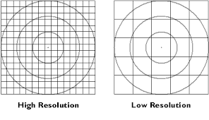
Geometric Resolution is expressed in the production of positional information as GSD (Ground Sample Distance) or YÖA (Yer Örnekleme Aralığı). GSD can be defined as the length on the ground corresponding to the pixel edge in the image file. In an image obtained from a satellite/aircraft/UAV with a geometric accuracy of 1 m, a pixel corresponds to an area of 1×1 meter on the ground, and the color tone of this area is represented in that pixel. The image file is formed by the combination of these pixels.
The ability to distinguish map objects on an image is directly proportional to the geometric and radiometric resolution of the image.

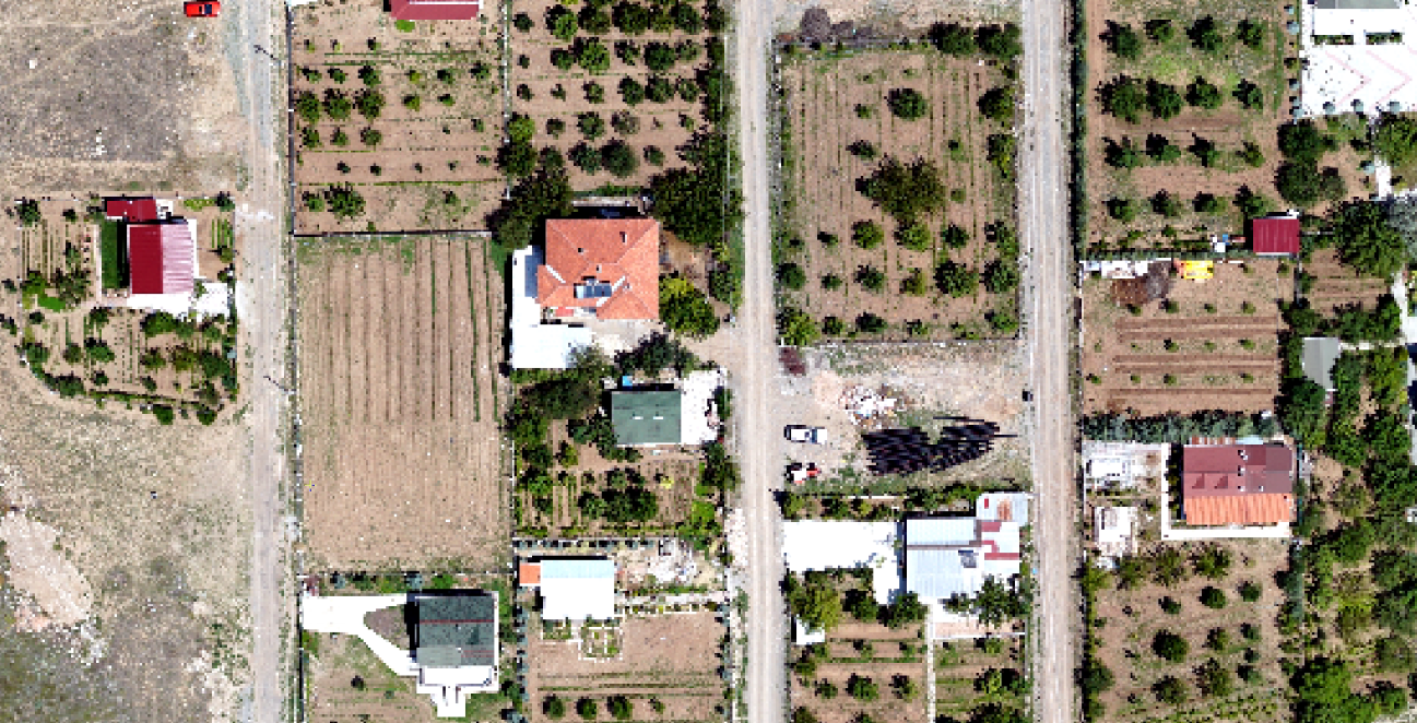
0.1m, 1 m ve 5 m resolution images
High geometric resolution images do not always mean high accuracy maps or Orthophotos. The accuracy of the final product also depends on the processing and digitization steps. Any improvements or errors made during these stages can affect the map or orthophoto’s accuracy.
When discussing the resolution of a satellite, aerial, or UAV image, it is important to consider not only the geometric resolution but also:
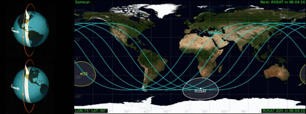
Temporal Resolution is defined as the time it takes for a satellite to acquire an image of the same location again after the initial acquisition. However, when discussing the revisit time, it is also important to consider the angle at which the image is acquired. For a satellite to image the same location nadir again, the required time can be 30 days, while it can be 2-3 days to image the same location with a different angle of +/- 30 degrees. However, in the literature, temporal resolution is generally used to refer to the time it takes to acquire an image of the same location, even if it is at a different angle, considering the attitude control capabilities of satellites. Therefore, in the example satellite given above, the temporal resolution value is given as 2-3 days.
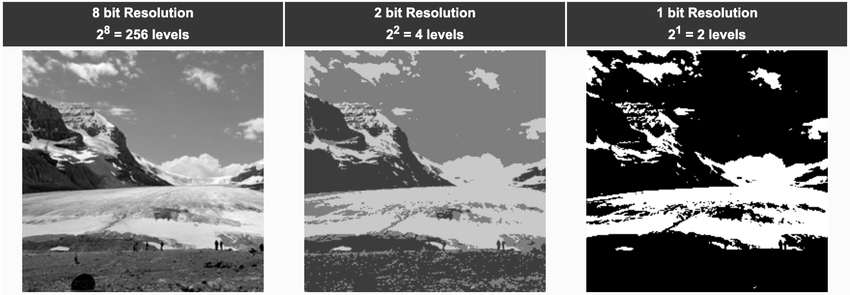
Radiometric Resolution is the sensitivity of the sensor to incoming radiance. Radiometric resolution is expressed as the number of quantization levels of the bit depth, for example, in 8-bit (28) data, each pixel’s data file value is divided into 256 (28) brightness values from 0 to 255, in 11-bit data into 2048 (211) brightness values, and in 16-bit data into 65,536 (216) brightness values.
Spectral Resolution is the range of wavelengths that a sensor records in the electromagnetic spectrum. As the range narrows, spectral resolution increases, and as the range widens, coarse spectral resolution is referred to.
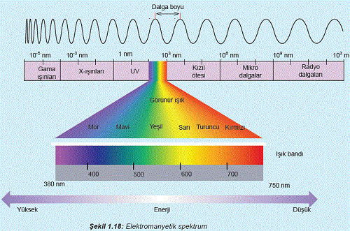
Better spectral resolution means a narrower wavelength range for a particular band. In other words, the higher the spectral resolution of a band or channel, the narrower the wavelength range that the band is sensitive to, or in other words, the range of wavelengths that are being acquired.
Details and different object classes in an image can be distinguished mainly by comparing their responses to different wavelength ranges. Broad classes, such as water and vegetation, can often be distinguished using very broad wavelength ranges, such as the visible and near-infrared. However, more specific classes (such as barley, wheat, and corn) cannot be easily distinguished using these two broad wavelength ranges (visible and near-infrared), and to distinguish them, they need to be compared in much narrower wavelength ranges. Therefore, a sensor with higher spectral resolution is needed.
When it comes to the spectral resolution of sensors, one might first think of the number of regions of the electromagnetic spectrum that they can sense. However, this band number alone does not correspond to spectral resolution. Rather, the position of these bands in the electromagnetic spectrum must also be considered.
WHICH RESOLUTION MEETS MY NEEDS?
We can help you answer this question.
DECIDING ON THE RESOLUTION
- Analyze well the details you want to see or interpret on the image.
- Take a look at the following examples to understand what can be seen at each resolution. Determine the importance of the details you want to see on the image. Analyze the project cost and image cost with the importance of the details you want to see.
- Continuously monitor the area of interest (AOI) that you will provide satellite imagery at a lower resolution. When a change is detected on the AOI, you can obtain more detail with higher resolution images.
WHAT CAN YOU SEE?
Think about the size of the object you want to monitor.
For example:
Vehicle monitoring:
- An average car is ~2m x 4.5m.
- 0.5m resolution: The car will cover 4 x 9 pixels. This is enough to perceive its color and general shape.
- Very High 0.3m resolution: The car covers 7 x 15 pixels, you can see better the shape and details like windows.
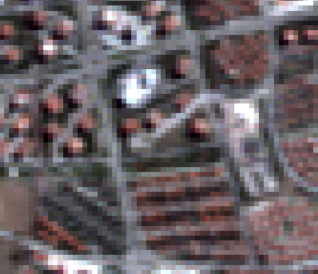
10m
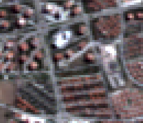
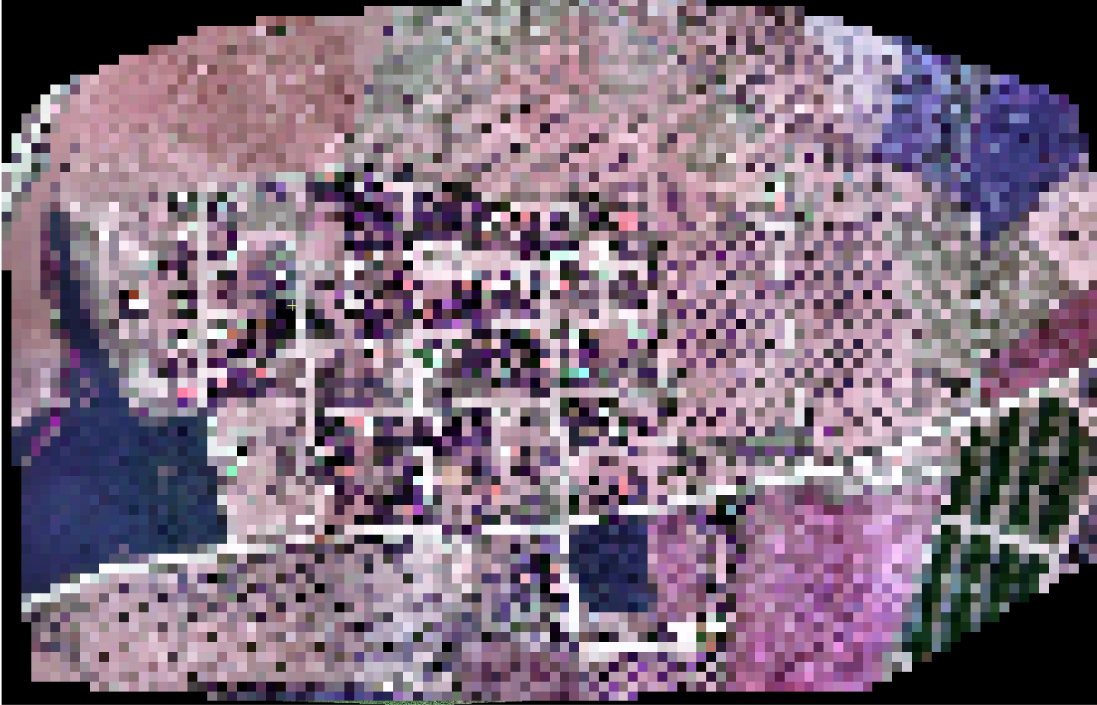
3m
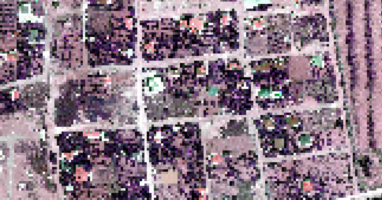

1.5m
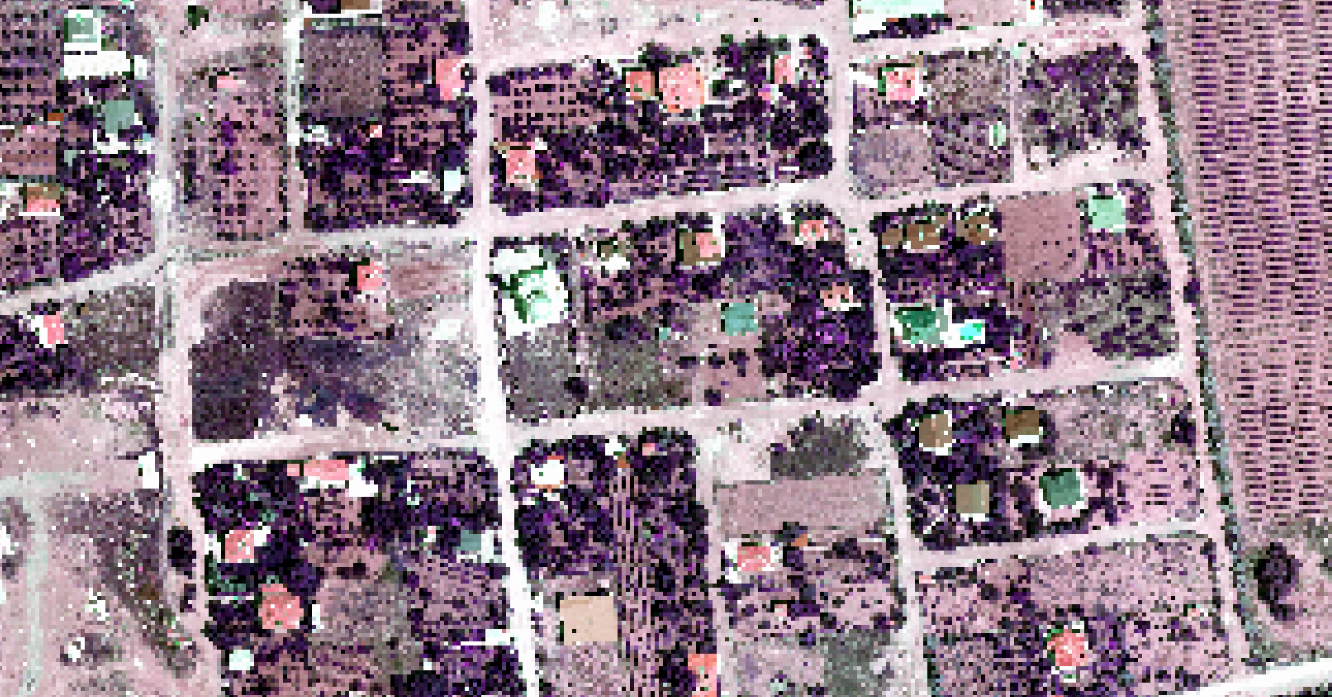

50cm
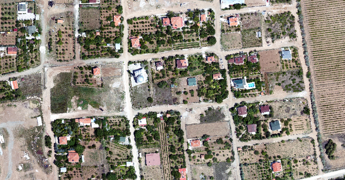
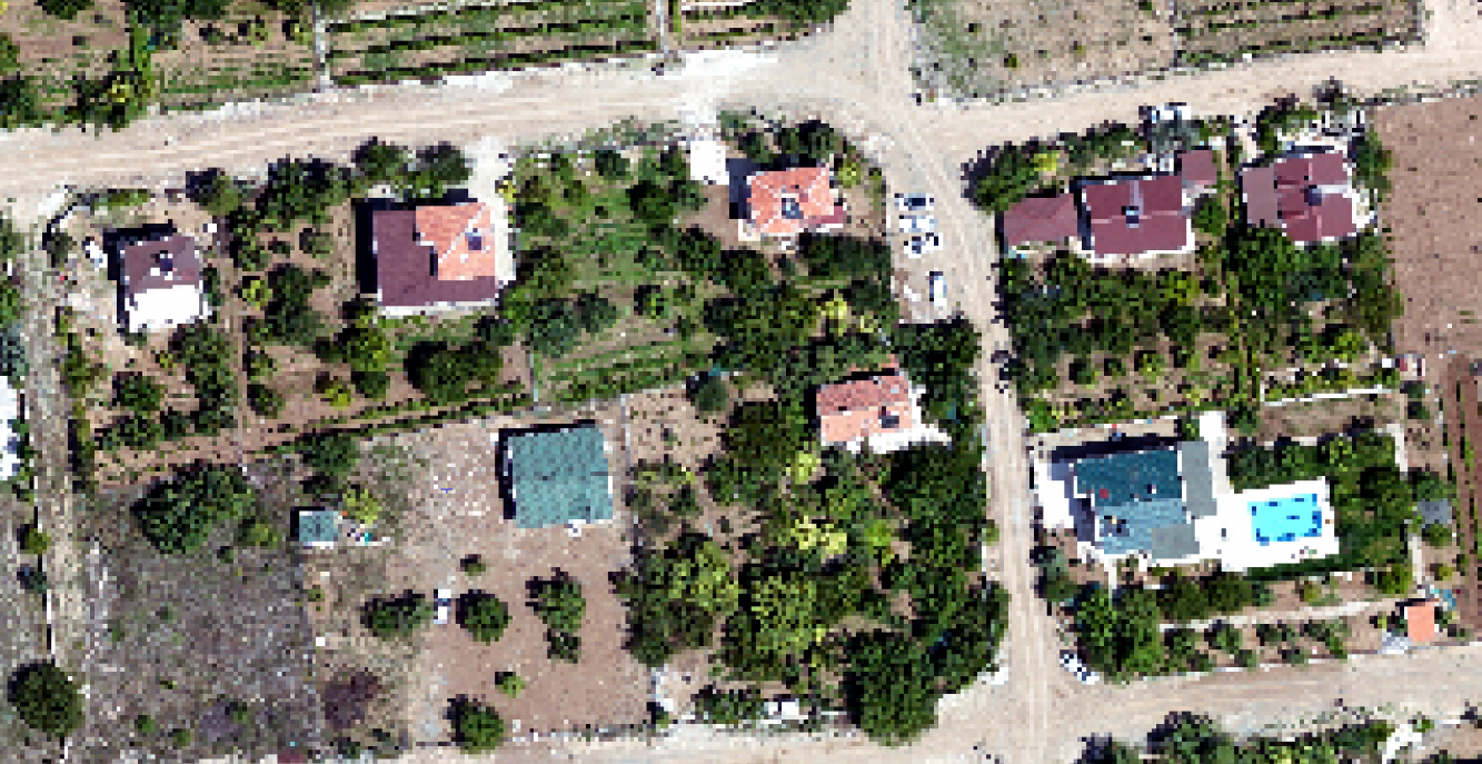
30cm
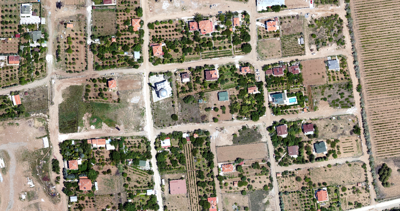
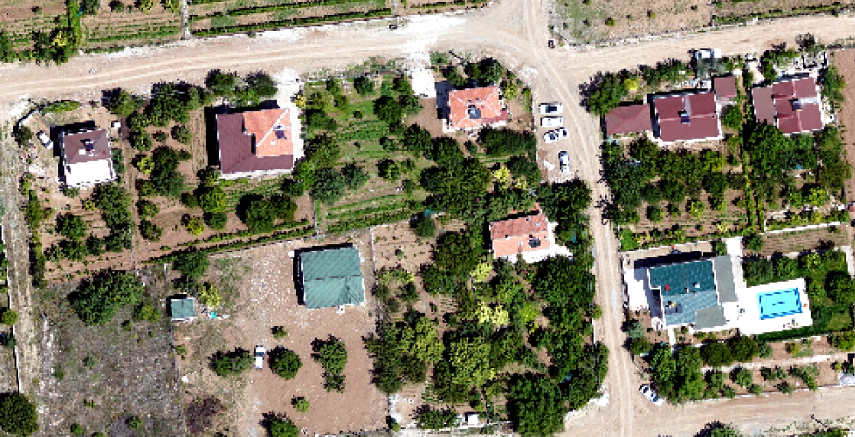
30cm

Low Resolution
10m
Example Use Cases:
- Large-scale (city-wide) monitoring
- Land change detection
- Infrastructure pattern identification
- Water body detection
- Multispectral bands provide additional information

Medium Resolution
3m
Example Use Cases:
- Infrastructure monitoring
- Land classification
- Change analysis – monitoring urban sprawl,
- Water body detection
- Vegetation monitoring
- Increased number of bands provide additional information

Medium Resolution
1,5m
Example Use Cases:
- Infrastructure monitoring
- Land classification
- Building detection/classification
- Detailed change detection
- Water body detection
- Vegetation monitoring

High Resolution
50 cm
Example Use Cases:
- Tree Counting
- Building Feature Detection
- Detailed Land Cover Classification and Change Detection
- Vehicle Detection
- Swimming Pool Detection
- Precision Farming Applications
- Rural Area Cadastre

Very High Resolution
30 cm
Example Use Cases:
- Tree Counting
- Building Feature Detection (e.g. Solar panels, chimneys)
- Detailed Land Cover Classification
- Vehicle Detection
- Swimming Pool Detection
- Road Feature Detection (e.g. Crosswalks, lanes, sidewalks)
- Pedestrian Tracking
- Precision Farming Applications
- Urban Area Cadastre
- Zoning Plan
- Asset Management


