
This week, we’ll discuss the use of satellite imagery in the mining sector.
The availability of satellite imagery has revolutionized how we understand what’s happening on our planet. From assisting farmers in increasing crop yields to aiding in disaster response, images and data collected from space play a significant role in various industries. One of the sectors benefiting most from the increasing availability of satellite imagery and other Earth observation (EO) data is mining.
The mining industry has made significant advancements in recent years by using satellite imagery for various purposes such as site monitoring, map production, discovery of mineral resources, and environmental monitoring.
Here are 5 ways in which Earth observation data can improve operations and encourage innovation in the mining industry:
Discovery of Mineral Resources
One of the most common applications of satellite imagery in the mining industry is to identify potential areas for the discovery of mineral resources and to map the distribution of minerals and other resources within a region.
Resource discovery is conducted by searching for specific geological features known to be associated with certain mineral deposits. For example, certain rock formations may indicate the presence of gold deposits, while others may have a higher likelihood of containing iron ore.
Mining operators can use satellite imagery to target exploration activities more efficiently by identifying these geological features, saving time and money. Satellite images also allow geographic information system (GIS) and remote sensing experts to map the distribution of minerals and other resources in the region. By combining satellite imagery with other data sources such as geological surveys, mining companies can better understand the composition of a specific area and identify potential areas of interest for exploration or extraction.
Mapping of Mining Areas
Using satellite imagery within GIS software, detailed maps of mining sites can be created, identifying the location of infrastructure such as topography, roads, and buildings.
Satellite images can also be used to identify potential future issues related to the mining area. Mining operators may want to review past images to see how the site has changed over time and identify potential issues such as topographic shifts that could affect the integrity of the mine structure and make predictions for the future.
Environmental Monitoring
Satellite imagery is an important tool for monitoring the environmental impacts of mining and managing rehabilitation efforts.
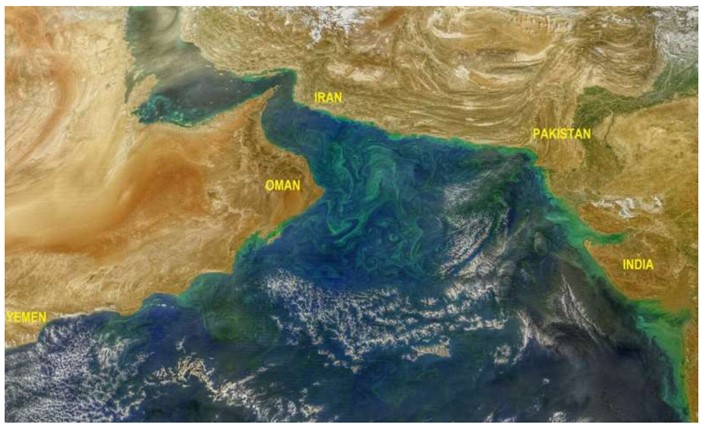
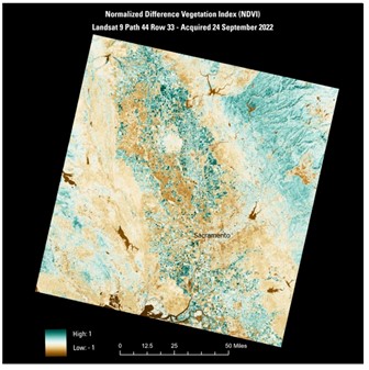
The use of satellite imagery to monitor environmental impacts associated with mining has increased in recent years. Large areas of land can be viewed at high resolution and relatively low cost. Satellite images can be used to monitor mining-related environmental impacts such as the extent of vegetation loss or changes in land use.
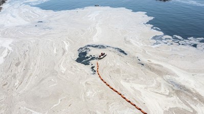
Satellite images can also be used to identify pollution sources from mines and monitor the spread of pollution.
In addition to monitoring environmental impacts, satellite imagery can support rehabilitation efforts. For example, pre- and post-images can be used to monitor the success of reforestation projects. Satellite images can also assess the long-term stability of mine waste dams. The information obtained from satellite images can be used to improve the sustainability of mining operations and minimize negative impacts on the environment.
Security Monitoring
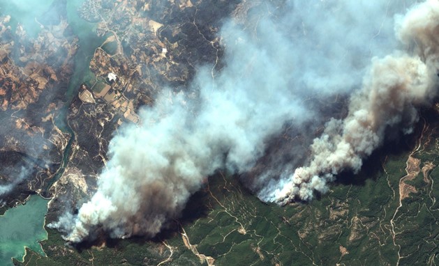
The mining industry uses satellite imagery to monitor mining sites for security hazards and identify potential risks before they become critical safety issues.
Satellite images can be used to monitor mining sites for various security hazards. For example, images can be used to identify unstable slopes or the presence of toxic substances that could threaten the integrity of the mine. Additionally, satellite data can be used to track the progress of security improvement efforts over time.
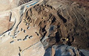
Satellite imagery is an important tool for keeping mine workers and communities safe. By monitoring mining sites for potential hazards, we can take steps to prevent accidents and protect both mining workers and the surrounding areas from harm.
Production Monitoring and Forecasting
Satellite imagery can be used to provide critical information about production to monitor the progress of mining operations and inform the next steps in the supply chain.
For example, operators can use satellite imagery to track the daily progress of the mine and monitor the movement of equipment and activities to increase efficiency and optimize production.
Satellite imagery and data can also be used to monitor the volume of extracted minerals, helping operators predict when sites need to be closed and plan for improvement efforts.

Satellite imagery has become an invaluable resource for the mining industry. It can inform various processes, from identifying mineral deposits to optimizing field operations and planning land rehabilitation efforts. This technology has revolutionized the management and operation of mines.
As satellite imaging continues to advance, it will further assist in supporting all aspects of the mining industry. Mining companies can better understand the geography of a region and plan and optimize their operations by using satellite imagery for resource discovery, survey planning, field mapping, and environmental monitoring.
Perhaps most importantly, satellite imagery can be used to monitor safety hazards and ensure the safety of workers and surrounding communities.
In conclusion, satellite imagery is a powerful tool for the mining industry. It can map potential exploration sites, detect the environmental impacts of operations, and track changes in land use. Companies in the mining sector can provide safe and efficient operations that preserve resources and avoid unnecessary risks by using the latest technology like this.
As technology continues to advance, new trends in mining are emerging, with two notable innovations being new trend mining and drone mining. New trend mining refers to the practice of identifying and capitalizing on emerging patterns and opportunities within the mining industry. This approach utilizes advanced data analytics and machine learning algorithms to forecast market trends, optimize production processes, and improve resource management. On the other hand, drone mining involves the use of unmanned aerial vehicles equipped with specialized sensors and cameras to survey and map mining sites with unprecedented accuracy and efficiency. By employing drones, mining companies can access remote or hazardous areas, gather real-time data, and enhance safety measures for their workers. These innovations signify a shift towards more sustainable and technologically-driven practices within the mining sector, promising increased productivity, cost-effectiveness, and environmental responsibility.
You can order the archive and/or new satellite imagery you need online at https://uydushop.com.tr.
Sedat BAKICI