

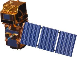
Sentinel 2 satellite images are part of the Copernicus program conducted by the European Space Agency (ESA) and are used for surface observations worldwide. Optical images with spatial resolutions ranging from 10m to 60m are provided by Sentinel 2. With a wide scanning width of 290 km and a high revisit time (10 days with one satellite at the equator, 5 days with two satellites under cloud-free conditions, and 2-3 days in mid-latitudes), it supports monitoring of surface changes on Earth, aiming to monitor variability in land surface conditions.
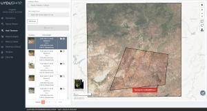
Sentinel 2 satellite images are available free of charge on uydushop.com.tr.
The various applications of Sentinel 2 satellite images include:
- Agriculture and Forestry Management: Sentinel 2 images can assist in managing agricultural processes such as monitoring farmland, assessing plant health, and predicting harvests. Similarly, they are used in forestry management for monitoring forests, forestry activities, and forest fires.
- Monitoring of Water Resources: Sentinel 2 images are used to monitor and manage issues related to water resources such as water quality, water levels, and water usage in lakes, rivers, reservoirs, and irrigation areas.
- Urban Planning and Land Use: Sentinel 2 images play a significant role in analyzing and planning land use, as well as monitoring urban growth and urban developments.
- Monitoring of Natural Disasters: Sentinel 2 images can be utilized to determine the impacts of natural disasters such as earthquakes, volcanic eruptions, fires, floods, and droughts, aiding in damage assessment and emergency response.
- Monitoring of Marine and Coastal Areas: These images are used for monitoring pollution, seaweed, changes in sea temperature, and marine ecosystems in seas and coastal regions.
- Environmental and Ecosystem Monitoring: Sentinel 2 images serve as an important data source for monitoring natural habitats, ecosystems, assessing biodiversity, and detecting environmental changes.
- Climate Change Research: These images provide data for climate change research by offering insights into atmospheric gases and surface changes related to climate change.
- Monitoring Soil Health and Erosion: Sentinel 2 images are used to monitor soil quality, erosion risk, and changes in soil usage.
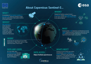
Sentinel 2 satellite images have a wide range of applications in various sectors due to their inclusion of RGB and infrared data. These application areas benefit different sectors such as environmental protection, sustainable development, emergency response, and scientific research.
If you’re an avid explorer or just someone who enjoys keeping tabs on our ever-changing world, you’ll want to download Sentinel free. This incredible tool offers unparalleled access to satellite imagery, providing a level of detail that surpasses even the better Google Earth. With Sentinel, you can zoom in on specific locations, track environmental changes, and gain insights into various phenomena like never before. Whether you’re a scientist, a student, or simply curious about our planet, Sentinel is a must-have resource.
Don’t forget to visit UyduShop!






