

Satellite imagery is a data source that plays a significant role in communication technologies and is widely used in visual and social media. These images are used to visually document spatial events worldwide, including political conflicts, environmental changes, natural disasters, urban growth, and many other topics. Satellite images can easily enhance stories and confirm that they provide a powerful resource for journalists’ reports.
If we list the importance and impacts of the use of satellite images in the media:
- Valuable Resources for News and Analysis: Satellite images are a powerful tool for journalists and news organizations. They are particularly used to monitor events in conflict zones, determine the impacts of natural disasters, or observe environmental changes. These images carry news value with their capacity to provide real-time information and ensure accurate reporting of events. Below are high-resolution satellite images taken before and after the Israel-Gaza war, showing the destruction in Gaza.
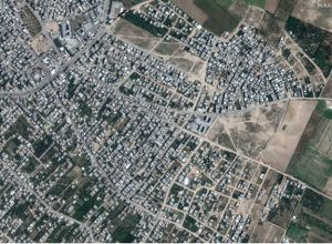
Before
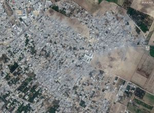
After
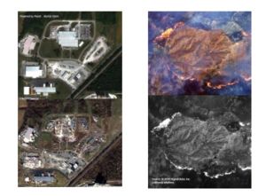
- Monitoring and Prevention of Natural Disasters: Satellite images are an important tool for monitoring natural disasters such as earthquakes, floods, and fires, and for assessing the impacts of these disasters. The data used to determine measures to be taken before and after a disaster helps coordinate rapid response and recovery operations.
- Environmental Change and Climate Analysis: Satellite images are used to monitor environmental changes on the earth and understand climate changes. Significant changes such as deforestation, melting of glaciers, and rise in sea level can be observed through satellite images, and this information can be disseminated to a wide audience by various media outlets.
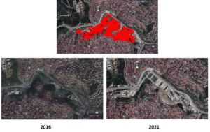
- Urban Transformation: Satellite images are used to monitor the changes in public works carried out to minimize the loss of life and property against possible earthquakes by systematically transforming a part or a significant portion of the city within the scope of a project.
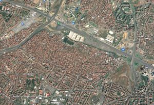
İstanbul / Fikirtepe 2009
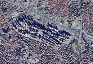
İstanbul / Fikirtepe 2023
-
- Archaeology and Scientific Research: Satellite images are an important resource for archaeologists and scientists in their research and discoveries. They are used in many areas such as the discovery of ancient settlements, detection of archaeological remains, topographic analyses, and geological studies.
- Education and Awareness: Satellite images are widely used in educational materials and documentaries. Students and the public benefit from these images to better understand the geographical features on the world map. They are also used in environmental awareness campaigns to raise awareness about the conservation of natural resources and sustainability issues.
In conclusion, satellite images are a powerful tool that helps visual and social media provide accurate and comprehensive information. These images visually document changes in the world, making news, analyses, and awareness campaigns more effective. Moreover, with the advancement of satellite technologies, the accessibility and usage of this data are increasing, further strengthening the role of media in information dissemination. In the media, seeing is believing.
To sum up media satellite imagery, often referred to as “satellite in press,” plays a pivotal role in modern journalism, offering unprecedented access to visual data from around the globe. Whether capturing the aftermath of natural disasters or monitoring geopolitical hotspots, satellite imagery provides journalists with a powerful tool for storytelling. With the increasing integration of satellite technology into newsrooms, reporters can now utilize satellite imagery to enhance their reporting, providing audiences with a more comprehensive understanding of complex issues. As satellite imagery continues to evolve, its impact on the press will only grow, shaping the way stories are researched, reported, and consumed.
If you are curious to learn more or want to explore satellite images with your own eyes, don’t forget to visit the UyduShop!
Hilal Yılmaz – Surveying Engineer, MSc






