

Satellite imagery has revolutionized archaeological research and the discovery of historical settlements. Regions that are difficult to access with traditional methods can now be easily examined thanks to satellite technology. In this blog post, we will discuss in detail the importance of satellite imagery in the detection and examination of ancient settlements and how it is utilized.
The Role of Satellite Imagery in Archaeology
Archaeology aims to understand the cultural and social structures of past societies. Excavation work carried out for this purpose can be time-consuming and costly. Satellite imagery accelerates this process by allowing archaeologists to examine large areas quickly and cost-effectively. Particularly in hard-to-reach regions, satellite imagery provides valuable information.
Detection of Ancient Settlements
- Landforms and Topography Analysis Satellite imagery is highly effective in creating topographic maps of large areas. Ancient settlements are often associated with specific landforms and topographic features. For example, ancient cities are usually located near rivers, hills, or valleys. Satellite imagery can identify these landforms and pinpoint potential archaeological sites.
- Vegetation Differences Ancient settlements can cause variations in vegetation over time. For example, the remnants of a wall or road can lead to changes in the type and density of the vegetation growing above it. Satellite imagery can detect these vegetation differences, revealing underground structures.
- Thermal Imaging Satellite thermal imaging technology can be used to uncover underground structures. Sunlight is absorbed and re-emitted in different ways by various underground materials. These temperature differences can be detected using thermal satellite imagery, helping to outline the boundaries of ancient settlements.
- Spectral Analysis
Satellite imagery includes data collected in various spectrums. Infrared, visible light, and other spectral bands help archaeologists identify different materials and surface features. For instance, certain types of stone or building materials become more distinct in specific spectral bands, facilitating the detection of potential archaeological sites.
Case Studies
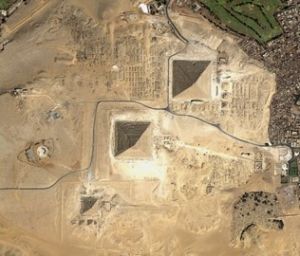
- The Pyramids of Egypt and Their Surroundings The pyramids of Egypt and the surrounding settlement areas have been studied in detail using satellite imagery. Satellite images have played a significant role in revealing quarries used for pyramid construction, worker camps, and ancient roads.
- Maya Cities Maya cities located in the dense forest regions of Central America have been discovered thanks to satellite imagery. In these areas, where the dense vegetation posed challenges, satellite images identified the road networks and large structures of ancient cities.
- Petra, Jordan The ancient structures and surroundings of Petra have been mapped and detailed using satellite imagery. These images have unveiled the topographic features and widespread structural remains of this ancient city.
- Ceyhan Plain In the region known as Cilicia Pedias in ancient times, there are many lost and undiscovered ancient settlements near modern residential areas. A study found that the archaeological sites in this region gave different spectral reflection values from the surface vegetation. Using this method, 42 unknown ancient settlements were discovered, in addition to known but damaged ones.
Satellite imagery has become an indispensable tool for archaeological research and the detection of ancient settlements. The ability to quickly and thoroughly examine large areas offers archaeologists significant time and cost advantages. Furthermore, the new settlements and structures discovered through satellite imagery allow for a more comprehensive understanding of history.
At UyduShop, we are proud to offer the latest satellite imagery technology for archaeological research and the detection of ancient settlements. Contact us to support your historical discoveries and add value to your archaeological projects.
Hilal Yılmaz – Surveying Engineer, MSc






