

In today’s world, satellites have become one of the most important sources of data. Used in agriculture, meteorology, military, environmental monitoring, and many other fields, satellite data provides vital information that facilitates daily life and supports scientific research. So, how do these satellites collect data from Earth and how do we access this data? Let’s explore this process step by step.
Collecting Data from Satellites
- Satellite Positioning: Satellites are placed in specific orbits to revolve around the Earth. These orbits vary depending on the type and mission of the satellite. For example, Earth Observation Satellites are often found in low Earth orbit (LEO), providing detailed images from a close proximity to Earth.
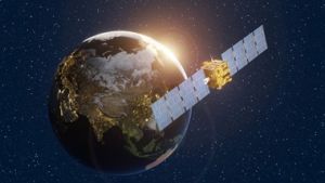
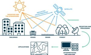
- Use of Sensors: Various sensors on satellites collect data from the Earth’s surface. These sensors can include optical cameras, radars, infrared, and ultraviolet scanners. Optical cameras capture images in visible light, while radar sensors can collect data through clouds and darkness.
- Data Collection and Processing: Satellites process raw data collected by sensors in real-time or store it for later processing. This data is typically compressed and filtered before being sent to Earth for analysis at large data centers.
Transmitting Data to Earth
- Ground Stations: Satellites send collected data to ground stations on Earth. These ground stations are equipped with large antennas and advanced receivers. As a satellite passes over a specific ground station, it transmits its data to that station.
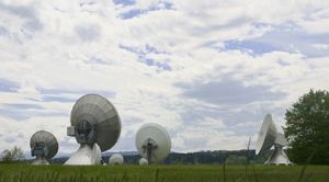
- Data Transmission Methods: Data transmission is usually carried out using radio waves or laser beams. Radio waves provide reliable communication over long distances but have limited data speeds. Laser communication offers higher data speeds but can be affected by atmospheric conditions.
- Data Processing and Analysis: Data reaching the ground stations is further processed and analyzed. This process involves converting raw data into user-friendly formats, creating maps, and optimizing it for specific applications. The data processing stage can be tailored to the needs of the user; for example, monitoring plant health for agriculture or analyzing urban expansion for city planning.
The Easiest Way to Access Satellite Data: UyduShop
Access to this valuable data obtained from satellites has now become much easier and more accessible. At this point, UyduShop’s on-line satellite image procurement platform comes into play. UyduShop is a web platform that offers a wide range of satellite images and data. Whether you want to monitor plant health in agriculture or want to develop new projects in urban planning, UyduShop offers satellite data for your needs.
You can easily provide satellite images through UyduShop, choose the data sets that suit your needs, and take your projects one step further. With Uydushop, you can also request a new image on-line. Visit UyduShop to explore the data obtained from satellites and strengthen your projects. Check out our website now to learn more and start exploring satellite data!
Hilal Yılmaz – Surveying Engineer, MSc






