

KOMPSAT-3 (Korean Multi-Purpose Satellite-3) is a space satellite developed by South Korea and launched in 2012. Its mission is to capture high-resolution optical images and create detailed maps of the Earth’s surface for use in various applications.
Kompsat-3 is in a sun-synchronous orbit at an altitude of 685 km and provides spatial resolution in the 0.7m PAN and 2.8m MS bands.
Launch and Function: KOMPSAT-3 was launched from Russia’s Yasny Space Base in 2012. The satellite orbits the Earth in a sun-synchronous orbit and captures images of the Earth’s surface daily. Since its launch in 2012, KOMPSAT-3 has provided high-quality images for various applications.
Observation Capabilities: KOMPSAT-3 has both multispectral and panchromatic (black and white) imaging capabilities. This provides detailed information about the color, structure, and components of objects on the surface. Additionally, the satellite’s high-resolution images are valuable for various areas such as land use planning, environmental monitoring, monitoring natural disasters, and military purposes.
KOMPSAT-3 serves as an example reflecting advancements in space technologies and remote sensing, making it an important source for monitoring and better understanding the Earth’s surface. KOMPSAT-3 images can be used in various applications such as agriculture, forestry, urban planning, disaster management, and environmental monitoring. They can also be utilized for military purposes.
While orbiting the Earth, the satellite provides up-to-date and continuous image data. These data are of great importance for science, governments, and commerce in many areas such as weather forecasting, monitoring natural disasters, and tracking the growth and changes of settlements.
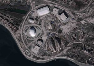
KOMPSAT-3 is also considered an example of South Korea’s capabilities in the space industry. The satellite has contributed to the country’s progress in space technologies and remote sensing, while also participating in international cooperation projects.

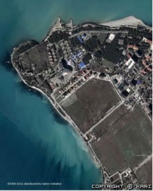
As a result, KOMPSAT-3 is a satellite of great importance for science, industry, and governments due to its high-resolution optical imaging capabilities. This enables detailed monitoring of the Earth’s surface and its use in various applications.
You can search the archive for satellite images and request new acquisitions through uydushop.com.tr. All these processes continue online. In archive images, you can purchase images for as small as 1 km2 without a limit on the size of the area and only pay for the km2 you acquire.
To sum up, Kompsat-3, a renowned Korean satellite, stands as a testament to the technological prowess of South Korea in the realm of space exploration. Launched with precision and fanfare, this satellite serves as a beacon of innovation, providing invaluable data and imagery for a myriad of applications. From monitoring environmental changes to aiding in urban planning, Kompsat-3 plays a crucial role in enhancing our understanding of the Earth and its dynamics. Its high-resolution imaging capabilities have revolutionized various sectors, including agriculture, disaster management, and infrastructure development. As we continue to harness the potential of space technology, Kompsat-3 remains a shining example of collaboration and excellence in the field of satellite technology.
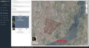
Don’t forget to visit UyduShop, which offers the fastest and most cost-effective images.






