

The agricultural sector plays a critical role in feeding the world’s population and driving economic development. However, the sustainability and productivity of agricultural production face various challenges. Factors such as climate change, limited water resources, declining soil fertility, and the excessive use of pesticides threaten the future of agriculture. In this context, precision agriculture applications emerge as an important tool to optimize agricultural production and ensure environmental sustainability. Satellite imagery, as a fundamental component of precision agriculture, provides valuable insights to farmers and agricultural experts for efficient and sustainable production. In this article, we will thoroughly examine the importance of satellite imagery in precision agriculture applications.
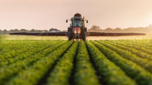
Precision Agriculture and Satellite Imagery
Precision agriculture is the use of advanced technologies and data analysis to increase efficiency in agricultural production and optimize resource use. Satellite imagery holds an important place among these technologies. By providing high-resolution, continuously updated data covering large areas, satellite imagery offers detailed information about the status of agricultural lands.
- Monitoring Crop Health and Stress Satellite imagery can be used to monitor the health status of vegetation. Normally, healthy plants reflect high amounts of light in specific wavelengths (especially near-infrared). Satellite sensors detect these reflections, providing information about plant health and stress. This helps farmers detect plant diseases, water stress, or nutrient deficiencies at early stages and take necessary measures.
- Irrigation Management Water is a vital resource for agricultural production, and proper irrigation management is critical for maximizing efficiency. Satellite imagery can be used to monitor the water status of agricultural lands. Data on soil moisture content and plant water stress allow farmers to optimize the timing and amount of irrigation. This ensures more efficient use of water resources and reduces water wastage.
- Soil Fertility and Nutrient Management Soil fertility is a fundamental factor for healthy and productive agricultural production. Satellite imagery provides information about soil nutrient content and organic matter status, helping farmers develop accurate fertilization strategies. This not only increases agricultural productivity but also reduces environmental pollution.
- Pest and Disease Management Weeds and plant diseases can cause significant losses in agricultural production. Satellite imagery can be used to monitor the spread of pests and diseases. Early detection of pests and diseases allows for timely intervention and control. This minimizes the use of chemical pesticides, reducing environmental impacts and leading to healthier crops.
- Yield Prediction and Harvest Planning Satellite imagery is used to predict agricultural production yields and plan harvests. By monitoring crop development, farmers can estimate the harvest time and expected yield. This optimizes harvesting operations and ensures that agricultural products reach the market on time.
Benefits of Satellite Imagery
- Wide Coverage and Accessibility Satellite imagery covers large areas, allowing the monitoring of extensive agricultural lands. This enables farmers to gain comprehensive information about the overall condition of their fields.
- High Resolution and Precision Modern satellite technologies provide high-resolution and precise images. This allows for the detection of even small-scale changes in agricultural lands.
- Data and Continuity: Satellite imagery enables near real-time monitoring of agricultural fields, facilitating dynamic management of agricultural production processes.
- Cost and Time Savings: Satellite imagery accelerates agricultural data collection processes and reduces costs. It offers the advantage of providing data more quickly and economically compared to traditional methods
Example Applications in Turkey
- Yield Prediction in Irrigated Wheat Fields in Şanlıurfa’s Ceylanpınar District A yield prediction study was conducted in irrigated wheat fields in Şanlıurfa’s Ceylanpınar district. In this study, a yield prediction model was developed using satellite imagery and various analyses. The model’s accuracy was tested using reflection data before, during, and after the wheat flowering period. According to the results, the highest accuracy rate of 82% was obtained from NDVI index tests conducted during the wheat flowering period.
- Study on the Phenological Stages of Potato and Sugar Beet Plants in Central Anatolia A study on the phenological stages of potato and sugar beet plants in Central Anatolia examined the multiband spectral reflection properties of these plants. Using data obtained from Landsat-8 and Sentinel-2 satellites, it was found that Red Edge, NIR, and SWIR bands provided important information for plant health and yield prediction. The study observed that all bands were close to each other in the days following planting, but there was an increase in bands sensitive to green tissue and a decrease in bands sensitive to the visible region during the second and third phenological stages when green tissue increased.
- Monitoring the Phenological Stages and Yield Prediction of Sunflower Plants Using Sentinel-2 Satellite Imagery The phenological stages and yield prediction of sunflower plants were monitored using Sentinel-2 satellite imagery. In this study, NDVI, NDVIre1, and SRre1 indices were used to track stages and calculate yield on a parcel basis in 48 sunflower parcels. A total of 23 Sentinel-2 images were used to determine the reflectance values of each parcel, and the correlation between plant indices and yield was examined. The stage with the highest correlation was identified as the flowering head formation stage. The most accurate results for NDVI analysis were obtained in June, while the best results for SRre1 analysis were achieved in July.
Satellite imagery is a crucial component of precision agriculture applications, providing accurate and reliable methods to address various issues. The benefits it offers in areas such as monitoring crop health, irrigation management, soil fertility, pest and disease management, yield prediction, and harvest planning are essential for optimizing agricultural production and ensuring environmental sustainability.
At Uydushop, we provide the latest satellite imagery technology for precision agriculture applications. You can contact us to enhance agricultural productivity and develop sustainable farming practices.
Hilal Yılmaz – Surveying Engineer, MSc






