

The insurance industry has been seeking new methods to enhance the effectiveness and efficiency of its services with the advancement of technology. In this context, satellite images have become a significant tool used in the insurance sector. In this blog post, we will discuss how satellite images are used in the insurance industry and the advantages they provide.
Damage Assessment and Evaluation
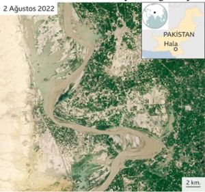
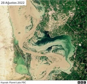
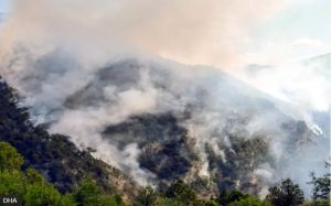
Satellite images allow for rapid and accurate damage assessment following natural disasters. For instance, after major events such as earthquakes, fire, floods, or hurricanes, insurance companies can quickly determine the extent of the damage through satellite images. This minimizes the cost and time loss associated with sending assessment teams to the field.
Risk Analysis and Management
Insurance companies can use satellite images to create risk profiles for specific areas. For example, regions with high flood risk, areas prone to wildfires, or earthquake zones can be analyzed more accurately through satellite images. These analyses play a crucial role in policy pricing and risk management.
Agricultural Insurance
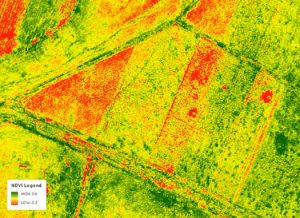
The use of satellite images in agricultural insurance is also increasing. Satellite images can be used to monitor crop growth, productivity, and potential damages. This allows for more accurate and fair insurance offers to be provided to farmers. Additionally, when harvest time comes, the condition of the crops can be quickly assessed through satellite images.
Fighting Fraud
Insurance fraud is a serious problem in the industry. Satellite images can be used as an effective tool to detect such fraud. For example, satellite images of an area where a person claims flood damage can be examined to verify if a flood actually occurred. This helps prevent unjust payments.
Infrastructure and Urban Planning
Satellite images also provide valuable information for the insurance sector in urban planning and infrastructure projects. Factors such as construction in newly developed areas, traffic density, and natural disaster risks can be considered in the preparation of insurance policies and risk management. This enables the provision of more accurate and appropriate insurance services.
Satellite images are bringing revolutionary changes and improvements to many areas within the insurance sector. From damage assessment and risk analysis to agricultural insurance and fraud detection, the benefits they provide enable insurance companies to offer more effective and efficient services. With the advancement of technology, the use of satellite images is expected to increase and become more widespread. Companies operating in the insurance sector can enhance their service quality and gain a competitive advantage by closely following this technology.
If you want to benefit from high-resolution satellite images, visit our UyduShop platform. UyduShop helps make your business processes more efficient and reliable by offering a wide range of satellite images for various needs. For more information, visit UyduShop.
Hilal Yılmaz – Surveying Engineer, MSc






