

Let’s seek an answer to the question: Where are Satellite Images Used? Satellite images are utilized in various sectors by providing imagery of every corner of the Earth. Captured by satellites in orbit, these images offer valuable insights and support a wide range of applications in different fields. Let’s examine some of the application areas where satellite images play a crucial role. Our topic is the application areas of satellite images.
- Environmental Observations
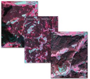
Satellite images have become indispensable tools for environmental observations. They assist in delineating forest boundaries, monitoring changes in land use and land cover, and observing the health of ecosystems. With the capability to capture large areas over long periods, satellites aid us in making informed decisions to protect our environment.
- Disaster Management
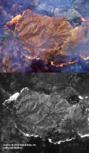
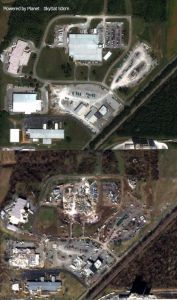
During natural disasters such as hurricanes, floods, and wildfires, satellite images provide critical information for disaster management. These images enable emergency response teams to assess the extent of damage, identify affected areas, and plan accordingly for aid distribution. Satellite data facilitates efficient intervention and rescue operations by assisting in predicting the path of a storm or monitoring post-disaster rescue efforts.
- Agriculture and Food Security
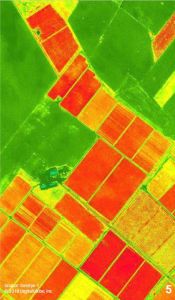
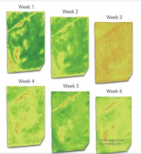
Satellite images assist in optimizing agricultural practices and ensuring food security. By monitoring crop health, soil moisture, and vegetation indices, farmers can make data-driven decisions regarding irrigation, fertilization, and pest control. This technology contributes to sustainable farming practices and global food security by aiding in the early detection of crop diseases, yield prediction, and crop productivity estimation.
- Urban Planning and Infrastructure Development
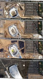
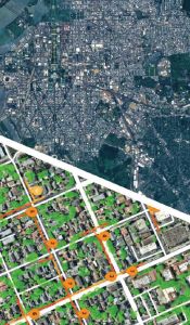
Satellite images provide valuable information for urban planners and geomatics/civil engineers. By analyzing land use patterns, population density, and infrastructure requirements, satellite data assists in making informed decisions for urban planning and development. It helps identify suitable areas for infrastructure projects, evaluate the environmental impact of urbanization, and monitor changes occurring in cities over time.
To sum up, satellite imagery has revolutionized our understanding of the world around us. Through the lens of these orbiting eyes, we gain unparalleled insights into the Earth’s surface, its changes, and its mysteries. Whether it’s monitoring weather patterns, tracking deforestation, or studying urban sprawl, satellite imagery provides us with a bird’s-eye view like never before. This technology has become indispensable in various fields, from environmental science to urban planning, enabling us to make informed decisions and take proactive measures to protect our planet. With the continuous advancement of satellite imaging technology, our ability to observe, analyze, and respond to changes on Earth grows ever more precise and powerful.
Satellite images have emerged as a powerful tool with various applications. From environmental monitoring to disaster management and urban planning, their widespread use continues to shape various industries and support sustainable development. You can benefit from satellite images by visiting UyduShop to procure images. Hopefully, this blog post examining the applications and details of satellite images has been helpful.






